Dr.
Matt Nolan
Water
and Environmental Research Center
Institute of Northern Engineering
University of Alaska Fairbanks
matt.nolan@uaf.edu
|
|
Dr.
Matt Nolan |
|
|
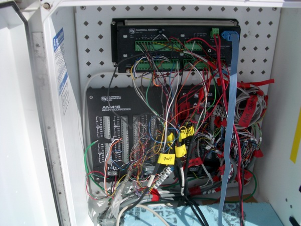
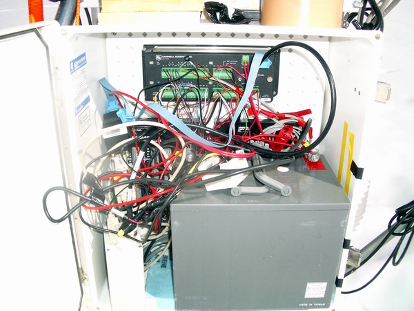
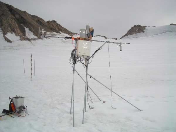
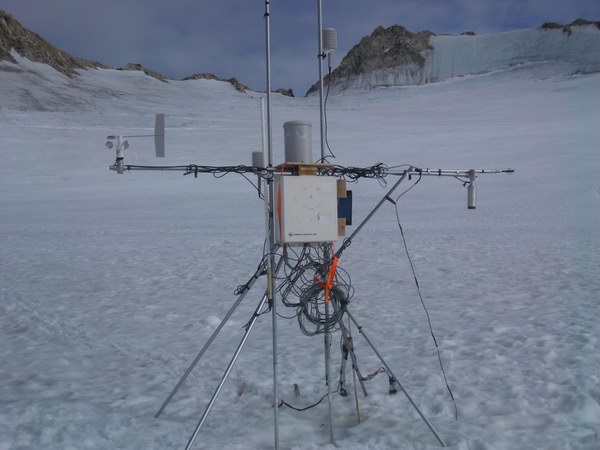
Station CORE The CORE met station was established in May 2004 at the location of an ice core extracted by the Japanese team led by Shuhei Takahashi. This station has been the most troublesome of all of them. In addition to standard weather instruments, it also has a 13.5m thermistor string into the ice and initially had many strain meters, tiltmeters, and compasses that we had installed in the firn. Troubles included one of the instruments shorting out and draining the battery during the first summer and a programming error in one of the AT/RH instruments that led us on a wild goose chase for quite a while. Overview Program
May 2004 - Aug 2004 Equipment failures: May 2004 The station was located about 5 meters away from the site of a core drill site, within view of the Japanese camera taking pictures of a snow stake. A decision was made to place the station here largely due to the firn study, where we wanted to measure whether the firn was sliding over the ice or not. Here the firn depth was only 2.5 m or so, making it easy to access the firn/ice contact. A better location for this station would have been further upglacier at the deepest firn area found, and likely a long-term met station will be placed there instead. Instruments:
20 July 2004 A day trip was made to determine why the CORE site stopped telemetering data. It was found that the battery was completely drained, likely due to a short in the compasses. The battery was replaced with a small one. The station was also listing, and bracing was added to keep it upright. It was a heavy melt year; note that this will affect SR50 measurements. Possibly splashed water into tipping bucket for testing. The station was left in running condition. August 2004 The station was found working in August, with the exception of the relative humidity measurements. However, it was clearly listing to the west and certainly would not survive another summer (maybe not even this summer), so we tore it down and reset the poles more deeply into the ice, adding tetra-type cross-bracing, also set into the ice. Instrument heights (before station
reset, 12 Aug 04): Instrument heights (after reset, 16
Aug 04): Notes:
September 2004 We made two day trips to CORE met to attempt to fix the broken relative humidity sensor. We replaced the lower AT/RH with a freshly calibrated one (24 Sept 04), but the next morning discovered that this was not the broken one, but the 3 m AT/RH was. I swapped nearly everything there the next day (25 Sept 04), including the cable, and concluded that it was either a bad logger port or an error in the program, so I wired the 3m RH to the next port in sequence on the mux and decided to figure it out at home using the telemetry, as it was cold and windy. It turned out to be an error in the program (the mux relay was not sequenced), but the offsets and multipliers used in the program turned the AT measurement into a realistic RH measurement, so it was hard to diagnose this initially. |
(c) 2003 Matt Nolan. If you find any broken links or other errors, please let me know. Thanks.