Dr.
Matt Nolan
Water
and Environmental Research Center
Institute of Northern Engineering
University of Alaska Fairbanks
matt.nolan@uaf.edu
|
|
Dr.
Matt Nolan |
|
|
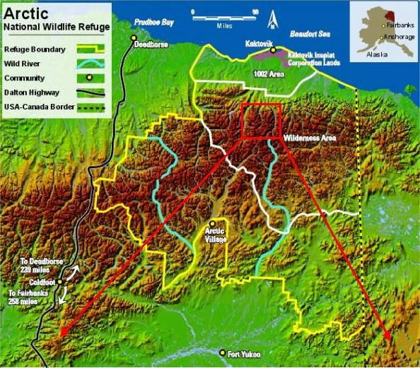
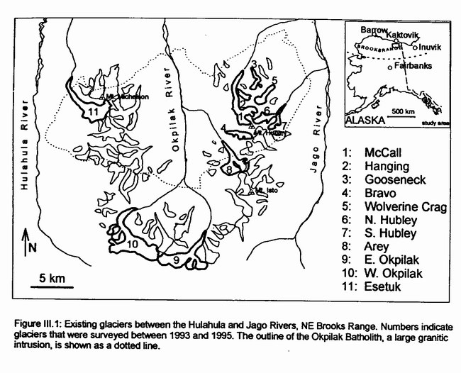
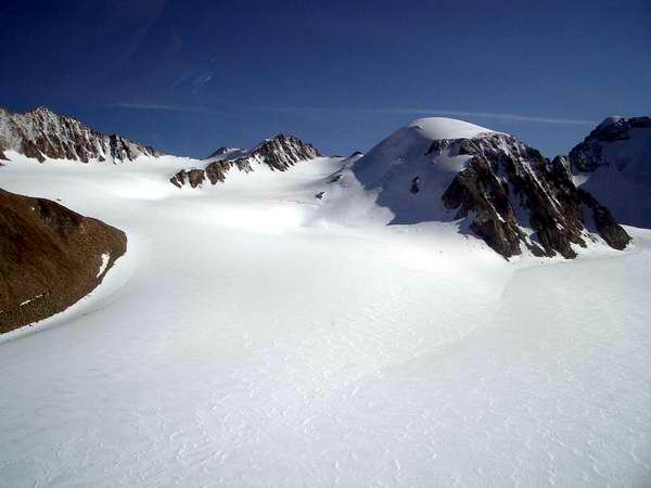
McCall Glacier: Location and Background McCall Glacier is located in northeastern Alaska, within the Romanzov Mountains of the Brooks Range. These mountains are part of the Arctic National Wildlife Refuge (ANWR), which is managed by the US Fish and Wildlife agency. This region of the Brooks Range swings far to the North and is only 60 miles from the Arctic Coast. This increase in latitude may be one reason why there are so many glaciers here as opposed to the central and eastern Brooks Range further south.
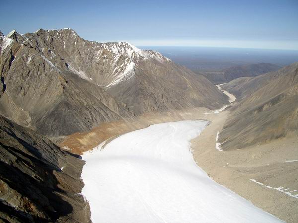
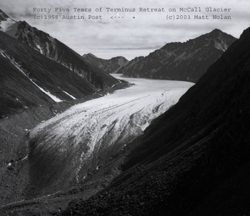
The earliest published observations of the glaciers that we have identified comes from a 1919 USGS publication by Ernest Leffingwell. Leffingwell spent several years in this region of the Arctic, mapping coastlines, geology, and geomorphology. On one of his trips inland he hiked up the Okpilak River valley to the Okpilak Glacier, where he took several photographs in 1906. These photos and his notes conclusively show that the glacial retreat in this area did not begin until sometime between 1890-1900. For example, the light colored moraine in the photo above (taken in 2003) was likely completely covered with ice in 1890. Scientific research on McCall Glacier began in 1957, as part of the International Geophysical Year studies occurring globally. Thus it predates the formation of ANWR in 1960. During the IGY studies, measurements were made of mass balance, ice velocity, ice volume, and ice temperature, among other things. A deep borehole was drilled in the accumulation area using heavy machinery to measure ice temperatures and study deformation. This borehole was our first indication that McCall Glacier, as is now recognized with many Arctic glaciers, retains a signficant volume of its own surface meltwater within its lower depths. That is, much of the snow melt observed at the surface refreezes internally out of sight in the lower layers of snow. This process is difficult to observe or measure, but the temperature measurements in that early borehole confirm that the process of refreezing surface melt water keeps the ice much warmer than it would be otherwise, as signficant amounts of heat must be released when so much water refreezes. The next detailed study of McCall Glacier occurred during 1969-1975 as part of the International Hydrological Decade studies occurring globally, with research led by Gerd Wendler, Carl Benson, Dennis Trabant and Charlie Fayl. These studies by UAF predate the creation of the Wilderness Designation for much of ANWR in 1980. During this IHY project, a network of over 70 stakes was maintained on the glacier surface to measure both mass balance and ice velocity, yielding much more detailed records than previously possible. A weather station and a hut were also established which are still in place today. The process of internal accumulation, described by the 1957 borehole, was studied in great detail, and much of the glaciological community's current knowledge of this subject dates to this work. Mass balance was found to be negative, as it was in the 1950s, though not as negative as in the subsequent studies in the 1990s. A network of about 10 thermocouple strings were placed in deep boreholes at many locations to determine how ice temperature can be used as a proxy for mean annual air temperature despite the influence of internal accumulation on ice temperature. These measurements form the basis of comparisons for all future temperature studies. The mid-1990s saw a renewed effort of UAF research on McCall Glacier. Between the IHY and the 1990s, there were only a few brief scientific trips to the glacier during which surface elevation measurements were made. The 1990s field research was the first major effort at documenting long-term change in the most important glacier variables. The entire IHY data-set was closely scrutinized, much of which had never been published. A field program was then designed and optimized for comparisons with those data. As a result, it was found that the rate of ice volume loss had increased substantially over this time period, due at least in part to an increase in mean annual ice temperature, presumably caused by a corresponding increase in air temperature. Patterns in mass balance showed a corresponding trend towards being negative. About 10 of the neighboring glaciers were studied during this time as well, primarily for surface elevation changes. This research was published in a PhD thesis by Bernhard Rabus and an associated set of journal articles. Between 1997 and 2001, a simplified mass balance stake network and weather measurements were maintained by UAF. The mass balance continued to be negative, though gradually less so. Terminus extents and some survey data were also collected. These data have not yet been rigorously analyzed in the context of the full McCall Glacier data set. Our project began in 2003. We have worked closely with many of the prior researchers here to ensure that our measurements are optimized for comparison with theirs. We have reoccupied all prior survey locations on the glacier and are maintaining a stake network that is equivalent in size to the IHY network. Our mass balance, ice volume, ice temperature, and weather measurements are all made with this prior research in mind. We have also begun a significant effort at data rescue and archival of prior research, including not only typical scientific measurements, but photos and oral histories as well. As of November 2003, we have completed two successful expeditions to the glacier and have two publications in progress. Some of the preliminary results can be found by following the links at left. This research on the glaciers of the ANWR region is part of a comprehensive NSF proposal to document changes in the freshwater storage elements in the Arctic hydrological system. Other aspects of this research include changes to lakes, aufeis, groundwater, soil moisture, permafrost and rivers. Other proposals in our program are working on larger-scale changes in terrestrial hydrology of the entire Arctic as well as changes in the Arctic Ocean. Our synthesis activities between projects is aimed at understanding the role of freshwater in the entire Arctic watershed and how these changes relate to global climate dynamics. The web page describing these activities can be found here. |
(c) 2003 Matt Nolan. If you find any broken links or other errors, please let me know. Thanks.